Visit Lolo Trail and Pass
Used by the nimíipuu long before Euro-Americans arrived, the route over the Bitterroot Mountains known as the Lolo Trail extends from Weippe Prairie to Lolo Pass along the Idaho-Montana border. Lewis and Clark followed this route in 1805. In July 1877, the non-treaty nimíipuu used this same trail seeking safety in Montana during the Flight.
Getting There
Lolo Pass can be accessed via U.S. Highway 12 (the Lewis and Clark Highway), which is a paved two-lane highway with speed limits of 50 mph or less. The route extends 150 miles from Greer, Idaho to Fort Fizzle in Montana.
For a closer look at the traditional trail, the Lolo Motorway (Forest Road 500) is a 119-mile primitive road that follows the historic route more directly. This single-lane, narrow, winding road is suitable only for high-clearance vehicles. Western access is via Forest Road 100 in the Kamiah area. Eastern access is via Parachute Hill Road or Saddle Camp Road near milepost 162 and 140 respectively on U.S. Highway 12. The road is generally free of ice and snow by mid-July and accessible into October.
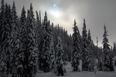
What You'll See
The Lolo Trail and Pass is an affiliated site of the Nez Perce National Historical Park, managed by the Nez Perce-Clearwater National Forest on the Idaho side and the Lolo National Forest in Montana. Historic signs mark the trail and explain the history of the nimíipuu, Lewis and Clark, and the Flight of 1877. The area offers picnic areas and excellent views of the mountain landscape.
Visiting Safely
The Lolo Pass Visitor Center, located on the Montana/Idaho border along U.S. Highway 12, has an interpretive center with information about the Lewis and Clark journey, the Nez Perce Flight of 1877, and the region. It features 24-hour restrooms, a covered picnic area, and a short interpretive trail. There is no cell phone service between Lolo, Montana and Kooskia, Idaho; emergency phones are located at mileposts 120, 139, and 169 on the Idaho side of Highway 12.